पर्यावरण, वन और जलवायु परिवर्तन मंत्रालय
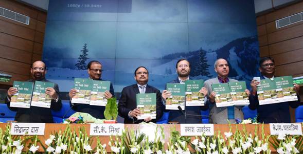
Released on 30th December 2019
Important to remember
Biennial publication of Forest Survey of India (FSI)
The ISFR measures the forest and tree cover, bamboo resources, carbon stock and forest fires.
* जंगलांमधून उत्पन्नावर प्रथमच राष्ट्रीय वन यादी तयार केली. ( national forest inventory for the first time.
राज्यांचा क्रम
Forest Cover
- Forest Cover (Area-wise) : Madhya Pradesh> Arunachal Pradesh> Chhattisgarh> Odisha> Maharashtra. (mp-ar-ch-o-ma)
- Forest Cover (Percentage): Mizoram (85.4%)> Arunachal Pradesh (79.63%)> Meghalaya (76.33%)
वनक्षेत्रात वाढ
- The country’s forest cover includes all patches of land with a tree canopy density of more than 10% and more than 1 hectare in area, irrespective of land use, ownership and species of trees.
- The total forest cover of the country is 7,12,249 sq km which is 21.67% of the geographical area of the country.
- The top five states to have shown an increase in forest cover include Karnataka (1,025 sq km) > Andhra Pradesh (990 sq km) > Kerala (823 sq km) > J&K (371 sq km) > Himachal Pradesh (334 sq km).
पूर्वोत्तर प्रदेशातील वन संरक्षणाची घट
- Total forest cover in the North Eastern region is 1,70,541 sq km, which is 65.05% of its geographical area.
- There has been a decrease of forest cover to the extent of 765 sq km (0.45%) in the region. Except Assam and Tripura, all the States in the region show decrease in forest cover.
महत्वाच्या नोंदी
- The total forest cover = 7,12,249 sq km = 21.67% of the geographical area of the country. The tree cover = 95,027 sq km = 2.89% of the geographical area.
- The total Forest and Tree cover = 8,07,276 sq km = 24.56% of the geographical area of the country.
- The current assessment shows an increase of 3,976 sq km (0.56%) of forest cover, 1,212 sq km (1.29%) of tree cover and 5,188 sq km (0.65%) of forest and tree cover put together, as compared to ISFR 2017.
- The top five States in terms of increase in forest cover are Karnataka (1,025 sq km), Andhra Pradesh (990 sq km), Kerala (823 sq km), Jammu & Kashmir (371 sq km) and Himachal Pradesh (334 sq km).
- The current assessment shows a decrease of forest cover to the extent of 765 sq km (0.45%) in the North Eastern region. Except Assam and Tripura, all the States in the region show decrease in forest cover.
- ( खारफुटी )Mangrove cover in the country has increased by 54 sq km (1.10%) as compared to the previous assessment.
- Total bamboo bearing area of the country is estimated as 1,60,037 sq km. There is an increase of 3,229 sq km in bamboo bearing area as compared to the estimate of ISFR 2017.
- In the present assessment, total carbon stock in forest is estimated as 7,124.6 million tonnes. There is an increase of 42.6 million tonnes in the carbon stock of the country as compared to the last assessment of 2017. The annual increase is 21.3 million tonnes, which is 78.1 million tonnes CO2 eq.
- Soil Organic Carbon (SOC) represents the largest pool of carbon stock in forests, which has been estimated 4,004 million tonnes. The SOC contributes 56% to the total forest carbon stock of the country.
- There are 62,466 wetlands covering 3.83% of the area within the RFA/GW of the country. The total number of wetlands located within the RFA/GW is 8.13%. Amongst the States, Gujarat has largest area of wetlands within RFA in the country followed by West Bengal.
- Dependence of fuelwood on forests is highest in the State of Maharashtra, whereas, for fodder, small timber and bamboo, dependence is highest in Madhya Pradesh. It has been assessed that the annual removal of the small timber by the people living in forest fringe villages is nearly 7% of the average annual yield of forests in the country.
- The information on area affected by five major invasive species in States/UTs based on analysis of NFI data has been given in the present ISFR.
- 21.40% area of forest cover of the country is highly to extremely fire prone.
